
Forest fire atlas to provide information realtime
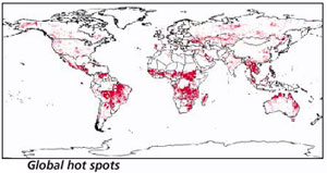 the European Space Agency (esa) has come out with a world fire atlas based on satellite data on forest fires collected over a decade. The maps are available to users online in near-real time (within six hours of a fire).
The data was taken from instruments called Along Track Scanning Radiometers aboard two esa satellites